
Jefferson ZIP Code Service Areas
Jefferson Township is served through several postal service areas rather than one municipal ZIP code. The township welcome packet supplies the verified local list below. It is a service-area reference, not a parcel-boundary file. That distinction matters because Jefferson is a Morris County tax jurisdiction, while postal delivery can use Oak Ridge, Newfoundland, Lake Hopatcong, Wharton, Stockholm, or Glasser. Use the table to recognize a label, then verify the individual address through USPS and county records.
| ZIP Code | Areas Covered | Post Office | Notes |
|---|---|---|---|
| 07438 | Oak Ridge/Milton | Oak Ridge PO and Jefferson Station | Serves much of the Milton section; parts of Oak Ridge are shared with West Milford |
| 07435 | Newfoundland portion | Newfoundland Main PO | Smaller Milton-area route; also serves portions of West Milford and Rockaway |
| 07849 | Lake Hopatcong | Lake Hopatcong Main PO | Includes lake-community and Jefferson mailing uses; do not confuse it with Hopatcong Borough |
| 07885 | Wharton-addressed areas | Wharton PO | A Wharton postal place can still identify a Jefferson tax parcel |
| 07460 | Stockholm | Stockholm Main PO | Township packet lists this service area; confirm each delivery address with USPS |
| 07837 | Glasser | Glasser PO | Township packet lists this service area; verify assignment at the parcel level |
Most Milton addresses use Oak Ridge 07438, with a smaller group using Newfoundland 07435. Lake Hopatcong addresses can use 07849 or the Wharton 07885 label. The municipal complex itself may use Oak Ridge or Lake Hopatcong mailing conventions. These are delivery patterns, not proof of which township governs a person, road, parcel, or tax record.
Note: No stable official ZIP-boundary map or documented Jefferson ZIP split year was located in the reviewed sources.
Jefferson ZIP Code Search Path
A ZIP code narrows a delivery area, but it does not open a ZIP-wide list in the inspected Morris property systems. The correct Jefferson ZIP code directory workflow moves from a postal result to municipality, then to district 1414 and a street or parcel identifier. This keeps a Wharton, Oak Ridge, or Lake Hopatcong label from sending a search into the wrong municipal data set. The county record uses place and parcel fields, not a postal boundary.
- Confirm the full delivery address with USPS. Keep the returned postal city and ZIP code, but do not treat either as the legal municipality.
- Open the Morris County tax or assessment search and select Jefferson district 1414. Search by house number and street name when known.
- Record the block, lot, qualifier, situs address, and owner shown in the tax result. Check whether the mailing address differs from the parcel location.
- Use the Morris GIS Parcel Searcher to confirm the parcel, then use the owner, town, legal description, or parcel identifier in the County Clerk document index when a recorded-document question remains.
- For one exact address after the ZIP has narrowed the area, use the Jefferson by-street directory for the fuller street and parcel record trail.
This workflow also avoids a false occupancy claim. A tax owner may be an estate, trust, company, or person who gets mail elsewhere. The situs field is the parcel’s physical location; the mailing field is only the tax-correspondence destination. A ZIP code can support the address search, but it cannot answer either question by itself.
Jefferson ZIP Code Portal Limits
The inspected public portals document a useful negative finding: neither Morris Tax Search nor the SR1A sales search exposes a ZIP code filter. The Tax Search uses property location, owner, block and lot, prior block and lot, tax year, district, and optional qualifier. The Jefferson assessment interface offers the same address and owner logic with output controls. County GIS quick search accepts municipality, owner name, street address, or parcel ID. None of those documented fields is a ZIP selector. The Jefferson ZIP code directory therefore points to an address workflow, not a ZIP-only county database.
| Morris property search field | Jefferson use | ZIP finding |
|---|---|---|
| Tax year and district | Select the tax year and Jefferson district 1414 | Required record context, not a postal field |
| Property location | Use street name and address after USPS confirms delivery information | No ZIP entry field inspected |
| Owner | Search a recorded owner, then compare situs and mailing information | No ZIP entry field inspected |
| Block, lot, qualifier | Use parcel identifiers to bridge tax, GIS, and deed records | Better historical keys than ZIP code |
| GIS quick search | Municipality, owner, street address, or parcel ID | No documented ZIP selector |
The Morris County Tax Search screen shows the location, owner, and parcel-style fields that replace a ZIP filter for Jefferson records.
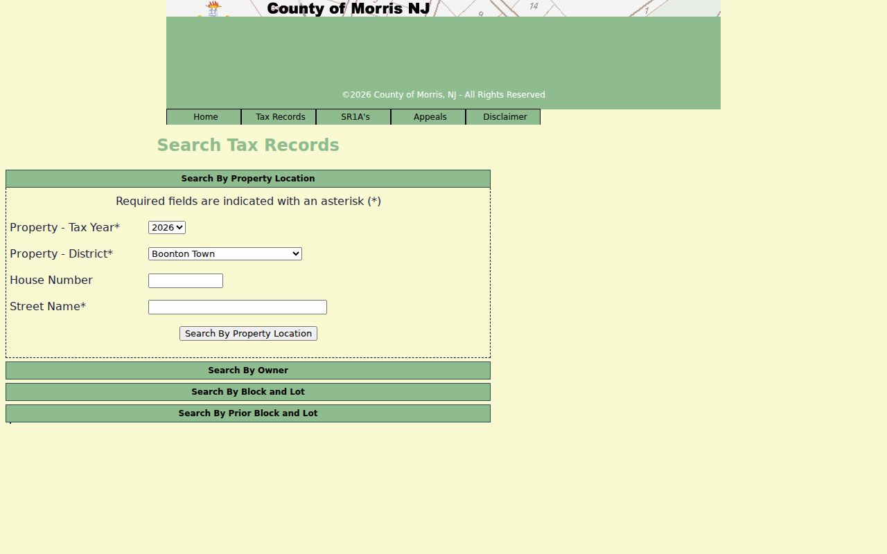
Start with the postal confirmation, then enter the street or parcel data the county system actually accepts.
Jefferson Postal-Place Mismatches
Myth: a Jefferson-related ZIP code proves that the address lies in Jefferson Township. It does not. Postal delivery geography and municipal taxing geography overlap without matching parcel by parcel. A Jefferson parcel can carry a neighboring post-office place, and an address with a familiar Jefferson-area ZIP may lie beyond the township. The Township’s two developed sections, Milton/Oak Ridge and Lake Hopatcong, are separated by long roads, lakes, forest, and preserved land, which adds to the label mix.
For research notes, retain four labels together: legal municipality, postal place, district 1414, and block and lot. This is the practical Jefferson bridge when a newspaper, directory, permit, or tax result uses different names. Route 15, Route 23, Route 181, Berkshire Valley Road, Oak Ridge Road, and Weldon Road can also appear in older material with a postal or lake-community description. The reviewed sources do not document a township-wide address renumbering or a ZIP realignment year, so do not invent one.
Postal confirmation and parcel confirmation answer separate questions. USPS determines whether mail is routed to a stated delivery address. The Tax Board identifies the Jefferson assessment record by municipality, district, and parcel fields. County GIS supplies a mapped location and may connect to tax data, but its published disclaimer says it is not a survey or legal description. When a land, title, or boundary question remains, compare the deed, recorded plat, survey, and the custodian’s record rather than relying on the postal label.
Jefferson’s lake and road communities make this distinction practical. Lake Hopatcong, Lake Shawnee, Lake Stockholm, Lake Swannanoa, Lake Winona, Cozy Lake, Longwood Lake, and Moosepac Pond can occur in local history or organizational material, but they are not all separate legal jurisdictions. A Jefferson ZIP code directory helps keep those community names in the search notes without converting them into municipal or parcel boundaries.
Insider tip. When a ZIP search reaches a dead end, search Jefferson district 1414 with block and lot before deciding the address is outside the township.
Jefferson ZIP Code Definitions
Postal terms are helpful labels, not parcel descriptions. The final authority for a legal boundary is the deed, recorded plat, survey, and the relevant municipal or county custodian. Morris GIS can locate a parcel and map its setting, but its disclaimer says the data is not a survey or legal description. A block and lot is usually the more reliable bridge from a ZIP code search to property, deed, permit, or map research. That is why the ZIP code directory should be read as a delivery-area reference rather than a tax map.
- ZIP code
- A postal delivery-routing label. It can cross municipal lines and does not determine tax jurisdiction.
- ZIP+4
- An added delivery segment that helps the Postal Service sort mail more precisely within a ZIP code.
- PO-box ZIP
- A postal ZIP used for post-office boxes. It does not describe all physical addresses served by that office.
- Unique ZIP
- A ZIP assigned for a single organization or delivery purpose. None was established for Jefferson in the reviewed local sources.
- Carrier route
- A mail-delivery sequence used by the Postal Service. It is not a municipal boundary or a public resident roster.
For historic addresses, compare the road name, cross streets, legal description, historical map, and directory entry rather than forcing an old address into a current ZIP code. The Morris County Archives, local library resources, and County Clerk records can supply the non-postal context that a modern delivery label leaves out.
Jefferson ZIP Code Voter Limits
The Morris County voter-status page sends an individual to the state registration check and polling-place search. It is not a ZIP-wide resident directory. Polling locations may be identified by ZIP or community and district, but the address should be used because Jefferson postal communities cross municipal boundaries. The live official form labels were not rendered in the research inspection, so the page does not claim fields that were not documented.
A voter list has separate statutory controls. Protected addresses, signatures, Social Security numbers, driver-license information, and similar identifiers are not open for general disclosure, and a participation record never indicates a ballot choice. For correction, protected-address, registration-history, or current list-procedure questions, contact the Morris County Board of Elections or Commissioner of Registration. That custodian route is more reliable than trying to turn a ZIP code into an election-district search.
Note: Use a street address and polling district for election questions, because a Jefferson ZIP code alone does not identify the proper electoral record.
Jefferson ZIP Code Delivery Check
USPS confirmation is the first step for a specific delivery address. The official Lake Hopatcong location page confirms the 07849 station and is a useful example of how a post-office result identifies a delivery service point, not township limits or property ownership.
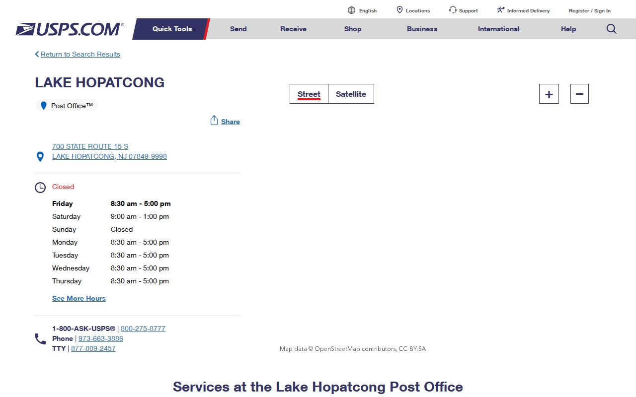
Once USPS returns the delivery label, switch to the Jefferson tax district, street, and block-and-lot fields for any parcel record question.